Tech-Enabled Feasibility Studies: Using Drones, Sensors & Remote Mapping
Feasibility studies have changed forever.
Traditional methods of site assessment once required extensive manual labour and time consuming processes. Now, drones, advanced sensors, and sophisticated remote mapping technologies are revolutionising the field.
This technological shift is making feasibility studies more accurate, more efficient, and significantly less expensive.
What is a feasibility study?
According to the Project Management Institute, a feasibility study is “an assessment of the practicality of a proposed plan or project, examining the viability of the project idea by evaluating technical, economic, legal, operational, and scheduling factors.”
Source: Project Management Institute. Feasibility Study. https://www.pmi.org/learning/library/feasibility-study-11065
This comprehensive evaluation helps organisations determine whether a project should proceed, be modified, or be abandoned before significant resources are committed.
The evolution of feasibility studies
What once required teams of surveyors spending weeks in the field can now be accomplished in days with greater precision and safety. This evolution represents a fundamental shift in how we approach project planning and risk assessment.
Modern feasibility studies leverage technology to gather more data, analyse it faster, and present findings in more accessible formats. This integration has become crucial in construction, agriculture, mining, energy, and infrastructure development.
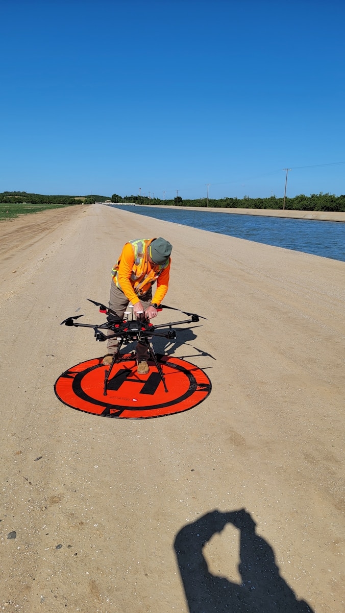
Drone technology: the eye in the sky
Aerial surveying and mapping.
Drones equipped with high resolution cameras and advanced GPS technology can capture detailed aerial imagery of vast areas in a fraction of the time required for traditional ground surveys.
Drones can survey hundreds of acres in a single day, capturing thousands of high resolution images. This reduces the need for expensive manned aircraft, scaffolding, or extensive ground crews. Drones eliminate the need for personnel to access dangerous or hard to reach areas. Sites that are difficult or impossible to reach on foot become easily accessible.
3D modelling and topographic analysis.
Modern drones do more than just capture photographs. Using photogrammetry and LiDAR technology, they create detailed three dimensional models of terrain and structures.
These 3D models provide invaluable insights for project planning. Accurate volume calculations. Slope analysis. Identification of potential challenges. The latest drone models can capture data with centimetre level accuracy.
Real time monitoring and updates.
One of the most significant advantages is the ability to conduct repeat surveys quickly and cost effectively. Project teams can monitor site changes over time, track environmental conditions, and update their feasibility assessments based on the most current data.
Advanced sensors: gathering critical data
Multispectral and hyperspectral imaging.
These advanced imaging technologies capture data across multiple wavelengths of light, going beyond what the human eye can see.
Applications include agricultural assessments analysing crop health and soil conditions. Environmental studies identifying vegetation types and detecting stressed plants. Geological surveys detecting mineral compositions. Water resource analysis mapping water bodies and assessing quality.
Thermal imaging sensors.
Thermal cameras detect heat signatures and temperature variations, providing insights invisible to standard cameras.
Applications include building inspections identifying heat loss and moisture intrusion. Energy assessments evaluating thermal performance. Water detection locating underground water sources. Equipment analysis assessing electrical systems and solar panels.
LiDAR technology.
LiDAR creates incredibly accurate 3D representations of terrain and structures by emitting laser pulses and measuring their return time.
Advantages include vegetation penetration through tree canopy to reveal ground topography. Precision mapping with accuracy levels of just a few centimetres. Volume calculations for stockpiles and excavation. Infrastructure assessment detecting subtle structural deformations.
Environmental sensors.
Modern feasibility studies incorporate specialised environmental sensors that measure air quality including particulate matter and pollutants. Noise levels for baseline acoustic measurements. Soil conditions including moisture content, compaction, and composition. Weather patterns for real time meteorological data.
Remote mapping technologies: the digital foundation
Geographic Information Systems.
GIS platforms have become indispensable tools, integrating multiple data layers to create comprehensive site analyses.
GIS allows project teams to layer multiple data sets combining topography, land use, utilities, and environmental constraints. Perform spatial analysis for viewshed calculations, flood risk assessments, and proximity analyses. Create compelling visual presentations for stakeholders. Model different development scenarios and immediately see their spatial implications.
Satellite imagery and remote sensing.
While drones excel at detailed, localised surveys, satellite imagery provides the broader context necessary for comprehensive feasibility studies.
Satellite data enables large scale monitoring across vast areas over extended time periods. Historical analysis accessing archived imagery to understand how sites have changed over years or decades. Accessibility for remote or politically sensitive areas. Multi temporal studies comparing imagery from different seasons or years.
Cloud based processing and collaboration.
Cloud based platforms enable real time collaboration and rapid data processing.
Multiple stakeholders can access and analyse the same data simultaneously from anywhere in the world. Cloud computing power processes massive datasets in hours rather than days. Version control ensures all team members work with the most current data. Scalability handles projects of any size without expensive local infrastructure.
Latest updates in tech-enabled feasibility studies in 2025
Artificial intelligence and machine learning integration.
AI algorithms are now being integrated into feasibility study workflows to automatically identify features, detect changes, and predict project risks. Machine learning models can analyse historical project data to improve accuracy in cost estimation, timeline prediction, and risk assessment.
Advanced computer vision algorithms can automatically detect and classify features such as buildings, roads, vegetation types, and terrain characteristics from aerial imagery.
5G enabled real time data transmission.
The rollout of 5G networks is enabling real time transmission of high resolution data from field sensors and drones directly to cloud processing platforms. Field teams can now receive instant feedback on data quality and coverage, ensuring comprehensive site assessment in a single visit.
Digital twin technology.
Digital twins, virtual replicas of physical environments that update in real time, are becoming increasingly important. These dynamic models integrate data from multiple sources including drones, sensors, and IoT devices to create living representations of project sites.
Autonomous drone operations.
Beyond visual line of sight drone operations and fully autonomous surveying missions are now possible. Drones can be programmed to conduct routine monitoring missions without direct pilot control, capturing consistent data over time with minimal human intervention.
Integration with Building Information Modeling.
Survey data from drones and LiDAR can now be directly imported into BIM software, creating accurate as built models that serve as the foundation for project design. This integration eliminates data translation errors and accelerates the transition from feasibility to design phases.
Quantum computing applications.
While still in early stages, quantum computing is beginning to impact complex optimisation problems in feasibility studies. Quantum algorithms can process multiple scenarios simultaneously, finding optimal solutions for site selection, logistics planning, and resource allocation.
Industry applications and case studies
Construction and real estate development.
Drone surveys and remote mapping reduce site assessment time by up to 75% while improving accuracy. Developers can quickly evaluate multiple potential sites, assess terrain challenges, and identify utilities or environmental constraints before purchasing land.
Agriculture and land management.
Multispectral imaging assesses soil health, identifies drainage issues, and evaluates irrigation infrastructure. Farmers and agricultural investors can make data driven decisions about crop selection, land improvements, and resource allocation.
Energy and infrastructure.
Renewable energy projects rely heavily on tech enabled feasibility studies to assess site suitability. LiDAR data provides precise terrain modelling for foundation planning, while meteorological sensors gather site specific data on solar radiation or wind patterns.
Mining and resource extraction.
Mining companies use advanced remote sensing to identify mineral deposits, assess site accessibility, and plan extraction operations. Hyperspectral imaging can detect mineral signatures invisible to conventional surveys.
Environmental conservation.
Conservation organisations employ these technologies to assess restoration sites, monitor protected areas, and plan conservation interventions. Drones can survey remote ecosystems without disturbing wildlife.
Benefits of tech-enabled feasibility studies
Enhanced accuracy and precision. Technology eliminates human measurement errors and provides data accuracy that exceeds traditional methods. Centimetre level precision in measurements ensures that project decisions are based on reliable information.
Significant time savings. What once took weeks or months can now be accomplished in days. Rapid data collection, automated processing, and instant access to results accelerate project timelines significantly.
Cost reduction. Tech enabled feasibility studies typically cost 30% to 50% less than traditional methods while delivering superior results. Reduced field time, smaller survey crews, fewer site visits, and earlier identification of potential problems all contribute to lower costs.
Improved safety. Removing personnel from hazardous environments reduces workplace accidents. Drones can inspect dangerous structures, survey unstable terrain, and assess contaminated sites without putting workers at risk.
Better stakeholder communication. Visual data such as 3D models, interactive maps, and fly through videos help stakeholders understand project concepts more clearly. This leads to faster approvals, reduced misunderstandings, and stronger stakeholder buy in.
Comprehensive documentation. Digital records create a permanent, detailed baseline of site conditions that can be referenced throughout the project lifecycle. This documentation is invaluable for resolving disputes and tracking changes.
Environmental responsibility. Tech enabled studies minimise environmental disturbance by reducing the need for ground based surveys that can damage sensitive ecosystems. Drones and remote sensors gather data with minimal environmental footprint.
Challenges and considerations
Regulatory compliance. Drone operations are subject to aviation regulations that vary by country and region. Obtaining necessary permits and certifications requires careful planning and legal expertise.
Data management. A single drone survey can produce hundreds of gigabytes of imagery and sensor data. Organisations need robust data management systems, sufficient storage capacity, and processing capabilities.
Technical expertise. Operating advanced technology and interpreting complex data requires specialised skills. Organisations must invest in training, hire specialised personnel, or partner with technology service providers.
Initial investment. While long term cost savings are substantial, the initial investment in drones, sensors, software, and training can be significant. Smaller organisations may struggle to justify these upfront costs.
Weather dependency. Drone operations and some sensor technologies are weather dependent. Rain, high winds, or poor visibility can limit data collection opportunities.
Data security and privacy. Collecting detailed imagery and sensor data raises privacy concerns, particularly in populated areas. Organisations must implement robust cybersecurity measures.
Technology integration. Integrating new technologies with existing project management workflows and legacy systems can be challenging. Organisations must ensure compatibility between different software platforms.
Implementation best practices
Start with a pilot project. Rather than attempting organisation wide transformation immediately, begin with a small pilot project to test technologies, develop expertise, and demonstrate value.
Invest in training. Allocate sufficient resources for comprehensive training programmes that cover both technical operation and data interpretation. Consider certification programmes for drone pilots.
Develop standard operating procedures. Create detailed protocols for data collection, processing, quality control, and reporting. Standardised procedures ensure consistency across projects.
Choose the right technology partners. Select equipment manufacturers and software providers with strong track records, reliable customer support, and commitment to ongoing development.
Prioritise data quality. Implement rigorous quality control measures throughout the data collection and processing workflow. Validate sensor calibration and verify georeferencing accuracy.
Plan for data management. Establish robust data management systems before beginning large scale data collection. Define naming conventions, storage locations, backup procedures, and access controls.
Engage stakeholders early. Introduce stakeholders to new technologies and their benefits early in the adoption process. Demonstrate capabilities through pilot projects and provide training on new deliverable formats.
Stay current with regulations. Monitor evolving regulations related to drone operations, data privacy, and professional standards. Maintain necessary licenses and certifications.
Where to start tomorrow
Do not try to implement every technology at once.
Start with one pilot project. Choose a site where technology advantages are clear.
Invest in training for your team. Certification for drone pilots. Software training from vendors.
Partner with experts if needed. You do not have to build all capabilities in house.
Establish your data management systems before you start collecting.
Document everything. Standard operating procedures. Quality control protocols. Lessons learned.
Final word
Tech enabled feasibility studies are transforming project planning.
Drones, advanced sensors, and remote mapping technologies deliver data that is more accurate, collected faster, and processed more efficiently than traditional methods.
The benefits are clear. Enhanced accuracy. Significant time savings. Cost reduction of 30% to 50%. Improved safety. Better stakeholder communication.
The challenges are manageable. Regulatory compliance. Data management. Technical expertise. Initial investment. All can be addressed with proper planning.
Organisations that embrace these technologies will gain competitive advantages. Faster project timelines. Lower costs. Better decisions.
The future of feasibility studies is here. Drones in the sky. Sensors on the ground. Data in the cloud. Insights at your fingertips.
Do not let outdated methods hold your projects back.
CALL TO ACTION
Ready to transform your project planning with tech-enabled feasibility studies?
At Stonehill Research, we are at the forefront of tech-enabled feasibility studies, combining cutting edge technology with deep industry expertise to deliver exceptional results for our clients.
Our Capabilities Include
State of the art drone fleet equipped with high resolution cameras, multispectral sensors, thermal imaging, and LiDAR technology. Advanced GIS and remote sensing platforms for sophisticated spatial analysis. Experienced multidisciplinary team with expertise across construction, agriculture, energy, and environmental sectors. Comprehensive reporting with interactive 3D models, detailed maps, and clear recommendations. Rapid turnaround times without compromising quality or accuracy. Commitment to safety, regulatory compliance, and environmental responsibility.
Why Choose Stonehill Research?
Cutting Edge Technology. We use the latest drones, sensors, and mapping technologies to deliver superior data quality.
Deep Expertise. Our team of certified drone pilots, GIS specialists, and experienced analysts understand your industry.
Proven Methodology. We have refined our processes to deliver accurate, actionable feasibility studies efficiently.
Commitment to Safety. We prioritise safety in all operations and maintain full regulatory compliance.
Contact Us Today
Whether you are planning a construction project, evaluating agricultural land, assessing renewable energy sites, or conducting environmental studies, Stonehill Research delivers the insights you need to make confident, data driven decisions.
📧 Email: info@stonehillresearch.com
📞 Phone: +234 802 320 0801
📍 Address: 5, Ishola Bello Close, Off Iyalla Street, Alausa, Ikeja, Lagos, Nigeria
Schedule a consultation today. Let us show you how drones, sensors, and remote mapping can provide the comprehensive data and insights you need for project success.
Stonehill Research – Your Partner in Tech-Enabled Feasibility Studies
REFERENCES
Project Management Institute. Feasibility Study. https://www.pmi.org/learning/library/feasibility-study-11065
There are no comments